Romford Canal remains at Dagenham Beam Bridge
Introduction
The photograph on this page of Romford Canal remains at Dagenham Beam Bridge by Robin Webster as part of the Geograph project.
The Geograph project started in 2005 with the aim of publishing, organising and preserving representative images for every square kilometre of Great Britain, Ireland and the Isle of Man.

There are currently over 7.5m images from over 14,400 individuals and you can help contribute to the project by visiting https://www.geograph.org.uk
Romford Canal remains at Dagenham Beam Bridge
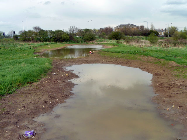
Image: © Robin Webster Taken: 2 Apr 2011
The reverse view to Image Although clearly remodelled as part of country park works, this is the course of the canal south of what is now the A1112. Early maps show a bridge under the road and what appears to be a basin north of the road. From that point on, there was to be a flight of four locks taking the canal away to the west from the Beam River. No work was ever done on these locks or anything else further north. Some evidence for the basin beyond the road is seen in Image
Images are licensed for reuse under creativecommons.org/licenses/by-sa/2.0
Image Location
Latitude
51.536043
Longitude
0.172022