Old railway bridge, Fairlop Loop
Introduction
The photograph on this page of Old railway bridge, Fairlop Loop by Robin Webster as part of the Geograph project.
The Geograph project started in 2005 with the aim of publishing, organising and preserving representative images for every square kilometre of Great Britain, Ireland and the Isle of Man.

There are currently over 7.5m images from over 14,400 individuals and you can help contribute to the project by visiting https://www.geograph.org.uk
Old railway bridge, Fairlop Loop
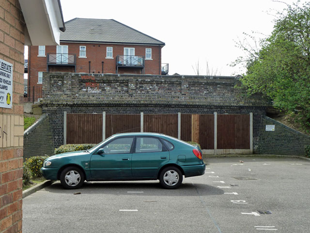
Image: © Robin Webster Taken: 2 Apr 2011
The Fairlop Loop left the Great Eastern main line roughly in the middle of what is now Ilford Depot, and ran north to loop around to join the Loughton - Epping - Ongar line. The first mile was abandoned when the rest of the line became part of the Central tube line - the tube coming to the surface south of Newbury Park station. There are three road over-bridges on the abandoned part, all seemingly in similar condition to this one - structurally intact but partly buried. This carries Vicarage Lane, the others, Benton Road and Wards Road. The building on the far side of the bridge is on the site of the north junction of the triangular connection to the main line and is part of the residential redevelopment of the site of the former Plessey Company, which occupied the land on the south side of Vicarage Lane from this bridge westwards to the junction with Ley Street and latterly used the junction site as a car park.
Images are licensed for reuse under creativecommons.org/licenses/by-sa/2.0
Image Location
Latitude
51.565436
Longitude
0.08858