Approaching Downshire station
Introduction
The photograph on this page of Approaching Downshire station by Albert Bridge as part of the Geograph project.
The Geograph project started in 2005 with the aim of publishing, organising and preserving representative images for every square kilometre of Great Britain, Ireland and the Isle of Man.

There are currently over 7.5m images from over 14,400 individuals and you can help contribute to the project by visiting https://www.geograph.org.uk
Approaching Downshire station
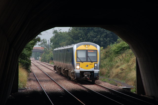
Image: © Albert Bridge Taken: 5 Sep 2006
Downshire station is crossed, at the Belfast end, by the Carrickfergus-Larne road. The 10.35 Belfast Central-Larne Harbour is framed by the road bridge as it approaches the platform.
Images are licensed for reuse under creativecommons.org/licenses/by-sa/2.0
Image Location
Latitude
54.72085
Longitude
-5.791844