Feature at the top of Stave Hill
Introduction
The photograph on this page of Feature at the top of Stave Hill by Stephen Craven as part of the Geograph project.
The Geograph project started in 2005 with the aim of publishing, organising and preserving representative images for every square kilometre of Great Britain, Ireland and the Isle of Man.

There are currently over 7.5m images from over 14,400 individuals and you can help contribute to the project by visiting https://www.geograph.org.uk
Feature at the top of Stave Hill
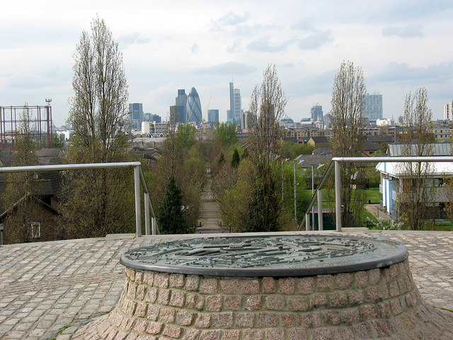
Image: © Stephen Craven Taken: 2 Apr 2011
This is the stone feature with a relief map, shown in more detail in Image For a view of the hill itself see Image and for the steps down the other side see Image The skyscrapers of the City of London can be seen in the background (the tallest of them at this time being the Heron tower).
Images are licensed for reuse under creativecommons.org/licenses/by-sa/2.0
Image Location
Latitude
51.501029
Longitude
-0.040585