Path to Dalmoak
Introduction
The photograph on this page of Path to Dalmoak by Lairich Rig as part of the Geograph project.
The Geograph project started in 2005 with the aim of publishing, organising and preserving representative images for every square kilometre of Great Britain, Ireland and the Isle of Man.

There are currently over 7.5m images from over 14,400 individuals and you can help contribute to the project by visiting https://www.geograph.org.uk
Path to Dalmoak
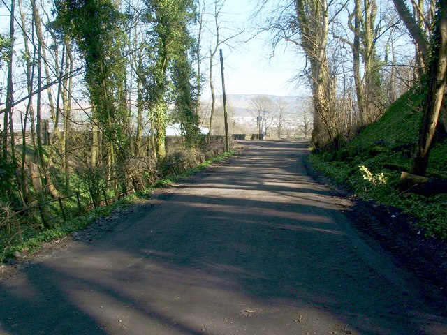
Image: © Lairich Rig Taken: 24 Mar 2011
The short section of the Kipperoch Road shown here is part of two core paths to Dalmoak, one from Cardross, the other from Hawthornhill. Ahead, both routes end at the main road: Image A large building is visible to the left, beyond the end of the path; it is part of Dalmoak Farm (Image). In the distant background, directly beyond the far end of the path, are the Lang Craigs, the escarpment of the Kilpatrick Hills: Image For a view of the same section of road in the opposite direction, see Image, which shows where the two distinct routes divide.
Images are licensed for reuse under creativecommons.org/licenses/by-sa/2.0
Image Location
Latitude
55.956989
Longitude
-4.588433