Lane off B4632
Introduction
The photograph on this page of Lane off B4632 by David P Howard as part of the Geograph project.
The Geograph project started in 2005 with the aim of publishing, organising and preserving representative images for every square kilometre of Great Britain, Ireland and the Isle of Man.

There are currently over 7.5m images from over 14,400 individuals and you can help contribute to the project by visiting https://www.geograph.org.uk
Lane off B4632
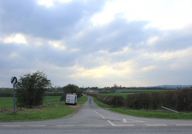
Image: © David P Howard Taken: 1 Apr 2011
View west from the junction on the B4632 down the lane towards Leys Farm. Compare with earlier photo Image A national speed limit sign is now on the left because the B4632 has a 50 mph limit at this point, but ironically the minor road has the higher national limit of 60 mph.
Images are licensed for reuse under creativecommons.org/licenses/by-sa/2.0
Image Location
Latitude
52.157873
Longitude
-1.732453