242-248 Norwood Road
Introduction
The photograph on this page of 242-248 Norwood Road by Stephen Richards as part of the Geograph project.
The Geograph project started in 2005 with the aim of publishing, organising and preserving representative images for every square kilometre of Great Britain, Ireland and the Isle of Man.

There are currently over 7.5m images from over 14,400 individuals and you can help contribute to the project by visiting https://www.geograph.org.uk
242-248 Norwood Road
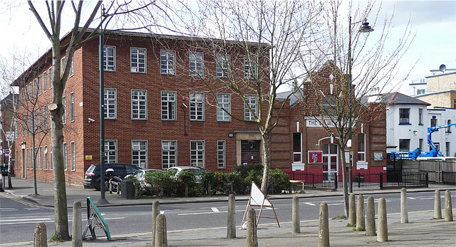
Image: © Stephen Richards Taken: 9 Mar 2011
Brick offices on the left, rather in the style of early-C20th telephone exchanges, and to its right the Salvation Army. On the far right is No. 242, an early-C19th stuccoed house currently occupied by a company offering lifting platforms for hire, hence the interesting machinery outside. Grade II listed.
Images are licensed for reuse under creativecommons.org/licenses/by-sa/2.0
Image Location
Latitude
51.437802
Longitude
-0.105737