The Shore Circular Path
Introduction
The photograph on this page of The Shore Circular Path by Lairich Rig as part of the Geograph project.
The Geograph project started in 2005 with the aim of publishing, organising and preserving representative images for every square kilometre of Great Britain, Ireland and the Isle of Man.

There are currently over 7.5m images from over 14,400 individuals and you can help contribute to the project by visiting https://www.geograph.org.uk
The Shore Circular Path
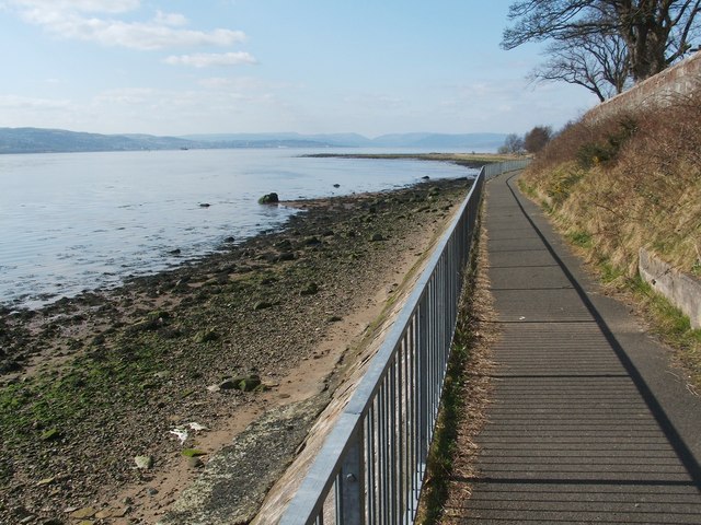
Image: © Lairich Rig Taken: 24 Mar 2011
The route is part of West Dunbartonshire's network of core paths. This section provides fine views out into the Firth of Clyde. The notch, just right of centre, in the distant line of hills marks the course of Glen Lean (Image), which is about 30 kilometres away. The wall to the right of the path encloses Image
Images are licensed for reuse under creativecommons.org/licenses/by-sa/2.0
Image Location
Latitude
55.939018
Longitude
-4.583871