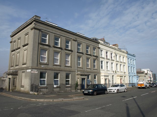
Victoria Place, Plymouth
Introduction
The photograph on this page of Victoria Place, Plymouth by Derek Harper as part of the Geograph project.
The Geograph project started in 2005 with the aim of publishing, organising and preserving representative images for every square kilometre of Great Britain, Ireland and the Isle of Man.
There are currently over 7.5m images from over 14,400 individuals and you can help contribute to the project by visiting https://www.geograph.org.uk

Image: © Derek Harper Taken: 26 Mar 2011
"Victoria Place is a planned terrace of five properties dating from the mid 19th century. These are of three storeys with three-bay frontages, with stucco detailing including moulded window surrounds, a band between the ground and first floors, and a moulded entablature. Four of the houses also have porches with pilastered doorways and moulded entablatures. However the character of this terrace has been severely eroded by the mix of replacement windows, loss of decorative mouldings and the use of modern render" http://www.plymouth.gov.uk/stonehouse_peninsula_conservation_area_appraisal_and_management_plan_part_6.pdf . Consequently the terrace is unlisted.

