Level crossing, Coleraine (5)
Introduction
The photograph on this page of Level crossing, Coleraine (5) by Albert Bridge as part of the Geograph project.
The Geograph project started in 2005 with the aim of publishing, organising and preserving representative images for every square kilometre of Great Britain, Ireland and the Isle of Man.

There are currently over 7.5m images from over 14,400 individuals and you can help contribute to the project by visiting https://www.geograph.org.uk
Level crossing, Coleraine (5)
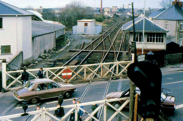
Image: © Albert Bridge Taken: 18 Feb 1989
See Image 22 years earlier the level crossing seen from the (now-removed) footbridge. One of Coleraine’s colour-light signals Image intrudes at bottom right. A new signal relay room had just been built on the stub of the old harbour branch (middle top).
Images are licensed for reuse under creativecommons.org/licenses/by-sa/2.0
Image Location
Latitude
55.134791
Longitude
-6.662866