Whit walk
Introduction
The photograph on this page of Whit walk by Anon as part of the Geograph project.
The Geograph project started in 2005 with the aim of publishing, organising and preserving representative images for every square kilometre of Great Britain, Ireland and the Isle of Man.

There are currently over 7.5m images from over 14,400 individuals and you can help contribute to the project by visiting https://www.geograph.org.uk
Whit walk
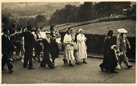
Image: © Anon Taken: 30 May 1954
The Whitsuntide walks were still widespread around Huddersfield in the fifties when this photo was taken on Vicarage Road Longwood approaching Quarmby Clough. My mother is dressed in my Sea Cadet uniform so I think 1954/5. Thanks to Rod Holmes for this pic.
Images are licensed for reuse under creativecommons.org/licenses/by-sa/2.0
Image Location
Latitude
53.645873
Longitude
-1.826908