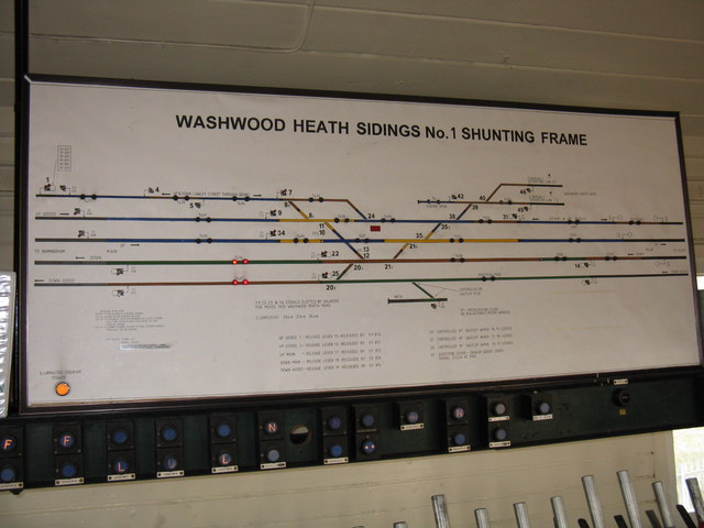
Washwood Heath Siding No. 1 Shunting Frame - the diagram
Introduction
The photograph on this page of Washwood Heath Siding No. 1 Shunting Frame - the diagram by Peter Whatley as part of the Geograph project.
The Geograph project started in 2005 with the aim of publishing, organising and preserving representative images for every square kilometre of Great Britain, Ireland and the Isle of Man.
There are currently over 7.5m images from over 14,400 individuals and you can help contribute to the project by visiting https://www.geograph.org.uk

Image: © Peter Whatley Taken: 29 Mar 2011
The signaller's diagram in this rather unusual survivor close by Saltley power signalbox. Effectively redundant since the closure of Washwood Heath Sidings, the shunting frame's every move has to be co-ordinated with Saltley which ultimately controls activities. The original intent under the 1969 resignalling scheme was to retain a local facility to enable quicker shunting manoeuvres. The shunting frame will be replaced (along ultimately with Saltley itself) by computerised signalling from the West Midlands Signalling Centre, just across the road from Saltley.

