Riccall, St. Mary's Church
Introduction
The photograph on this page of Riccall, St. Mary's Church by Bill Henderson as part of the Geograph project.
The Geograph project started in 2005 with the aim of publishing, organising and preserving representative images for every square kilometre of Great Britain, Ireland and the Isle of Man.

There are currently over 7.5m images from over 14,400 individuals and you can help contribute to the project by visiting https://www.geograph.org.uk
Riccall, St. Mary's Church
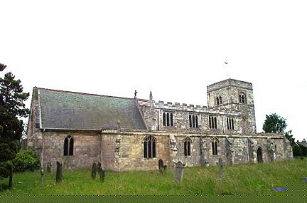
Image: © Bill Henderson Taken: Unknown
This Church is in the north eastern corner of the O/S grid it occupies. Built on the site of a Saxon chapel, St.Mary's is made of local Tadcaster magnesian limestone and the presence of a church is mentioned in the Domesday Book. The most treasured feature is a beautiful doorway (dated 1160 AD), the arch of which has four bands of richly carved figures and symbols - with some beakheads displaying a Viking influence. A low three stage tower was added in 1180 AD - the belfry has four Norman double window openings.
Images are licensed for reuse under creativecommons.org/licenses/by-sa/2.0
Image Location
Latitude
53.832781
Longitude
-1.060939