Studfold Ring
Introduction
The photograph on this page of Studfold Ring by Gordon Hatton as part of the Geograph project.
The Geograph project started in 2005 with the aim of publishing, organising and preserving representative images for every square kilometre of Great Britain, Ireland and the Isle of Man.

There are currently over 7.5m images from over 14,400 individuals and you can help contribute to the project by visiting https://www.geograph.org.uk
Studfold Ring
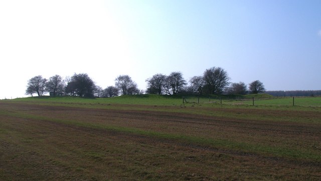
Image: © Gordon Hatton Taken: 27 Mar 2011
Seen from the east, this feature appears as a low bank with small trees on and within the earthwork. One would assume that this is a prehistoric site, but it appears to be largely medieval and would have been used as some sort of corral for horses.
Images are licensed for reuse under creativecommons.org/licenses/by-sa/2.0
Image Location
Latitude
54.211009
Longitude
-1.110037