Lane End: Signs
Introduction
The photograph on this page of Lane End: Signs by Nigel Cox as part of the Geograph project.
The Geograph project started in 2005 with the aim of publishing, organising and preserving representative images for every square kilometre of Great Britain, Ireland and the Isle of Man.

There are currently over 7.5m images from over 14,400 individuals and you can help contribute to the project by visiting https://www.geograph.org.uk
Lane End: Signs
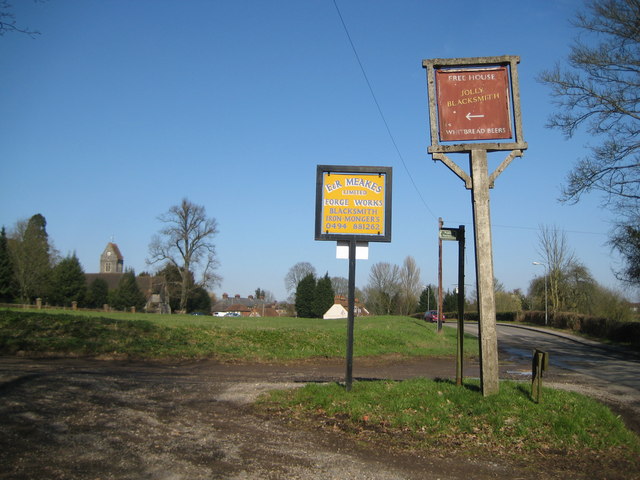
Image: © Nigel Cox Taken: 19 Mar 2011
There are a couple of fine signs here, advertising the presence of Image Image across Ditchfield Common to the left. Image is visible to the left. Church Road is to the right.
Images are licensed for reuse under creativecommons.org/licenses/by-sa/2.0
Image Location
Latitude
51.61638
Longitude
-0.836697