Ford on the Thame
Introduction
The photograph on this page of Ford on the Thame by Des Blenkinsopp as part of the Geograph project.
The Geograph project started in 2005 with the aim of publishing, organising and preserving representative images for every square kilometre of Great Britain, Ireland and the Isle of Man.

There are currently over 7.5m images from over 14,400 individuals and you can help contribute to the project by visiting https://www.geograph.org.uk
Ford on the Thame
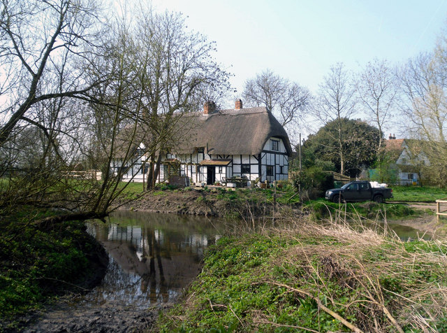
Image: © Des Blenkinsopp Taken: 25 Mar 2011
The track down here is labelled a Restricted Byway, which is a good description. This is a seriously deep and muddy ford even with the river at a reasonably low level as in this picture. Tracks in the mud show that a tractor has used this recently, but to suggest it's a viable river crossing is a bit of a joke.
Images are licensed for reuse under creativecommons.org/licenses/by-sa/2.0
Image Location
Latitude
51.659605
Longitude
-1.136012