Keep out ! Coal Authority land, Blaencwm
Introduction
The photograph on this page of Keep out ! Coal Authority land, Blaencwm by Jaggery as part of the Geograph project.
The Geograph project started in 2005 with the aim of publishing, organising and preserving representative images for every square kilometre of Great Britain, Ireland and the Isle of Man.

There are currently over 7.5m images from over 14,400 individuals and you can help contribute to the project by visiting https://www.geograph.org.uk
Keep out ! Coal Authority land, Blaencwm
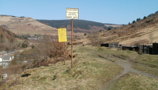
Image: © Jaggery Taken: 23 Mar 2011
I of course remained on the safe, public side of the notices. Under a depiction of a skull and crossbones, the yellow notice warns of steep slippery slopes and risk of injury from sliding, falling and obstacles. The notices are located on the hillside on the south side of Michael's Road, Blaencwm.
Images are licensed for reuse under creativecommons.org/licenses/by-sa/2.0
Image Location
Latitude
51.67665
Longitude
-3.563353