Pencepool Farmhouse, Plymtree
Introduction
The photograph on this page of Pencepool Farmhouse, Plymtree by Derek Harper as part of the Geograph project.
The Geograph project started in 2005 with the aim of publishing, organising and preserving representative images for every square kilometre of Great Britain, Ireland and the Isle of Man.

There are currently over 7.5m images from over 14,400 individuals and you can help contribute to the project by visiting https://www.geograph.org.uk
Pencepool Farmhouse, Plymtree
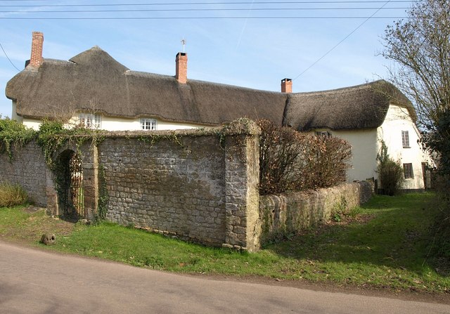
Image: © Derek Harper Taken: 19 Mar 2011
A fine C16 "attractive and well-preserved multi-phase Devon farmhouse" http://www.britishlistedbuildings.co.uk/en-86909-pencepool-farmhouse-including-service-out listed at grade II*, with "a long and complex structural history". In addition, the front garden walls in the foreground are listed separately and described at http://www.britishlistedbuildings.co.uk/en-86910-front-garden-walls-approximately-2-metres . The taller section with the doorway is late C16-early C17.
Images are licensed for reuse under creativecommons.org/licenses/by-sa/2.0
Image Location


Leaflet Map data © OpenStreetMap
Latitude
50.819844
Longitude
-3.346593