Wymondham town sign
Introduction
The photograph on this page of Wymondham town sign by Stephen McKay as part of the Geograph project.
The Geograph project started in 2005 with the aim of publishing, organising and preserving representative images for every square kilometre of Great Britain, Ireland and the Isle of Man.

There are currently over 7.5m images from over 14,400 individuals and you can help contribute to the project by visiting https://www.geograph.org.uk
Wymondham town sign
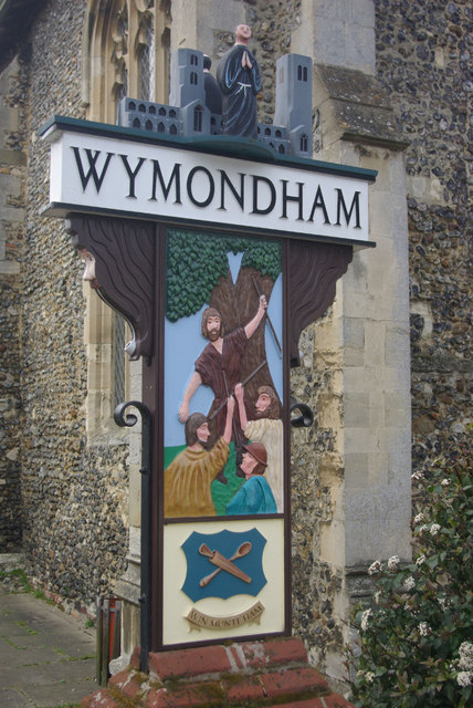
Image: © Stephen McKay Taken: 20 Mar 2011
Signs in this style are common throughout East Anglia. Wymondham's monastic history is depicted by the monk and the abbey church; below the name is a reminder of Kett's rebellion in the 16th century.
Images are licensed for reuse under creativecommons.org/licenses/by-sa/2.0
Image Location
Latitude
52.571052
Longitude
1.110411