Rugby Rooftops
Introduction
The photograph on this page of Rugby Rooftops by Ian Rob as part of the Geograph project.
The Geograph project started in 2005 with the aim of publishing, organising and preserving representative images for every square kilometre of Great Britain, Ireland and the Isle of Man.

There are currently over 7.5m images from over 14,400 individuals and you can help contribute to the project by visiting https://www.geograph.org.uk
Rugby Rooftops
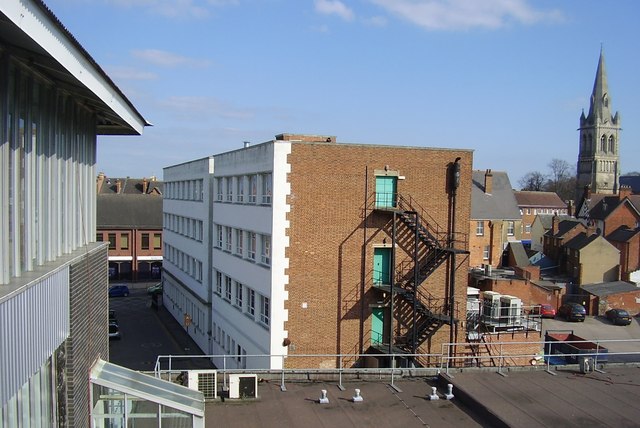
Image: © Ian Rob Taken: 23 Mar 2011
A view from the car park of the Clock Towers Shopping Centre. The office block in the centre of the photo was until the 1960s the headquarters of Rugby Portland Cement, the ground floor is now the Nat West Bank with office suites above. Saint Andrew's Church can be seen top right.
Images are licensed for reuse under creativecommons.org/licenses/by-sa/2.0
Image Location


Leaflet Map data © OpenStreetMap
Latitude
52.373451
Longitude
-1.26405