Woodborough Baptist Church
Introduction
The photograph on this page of Woodborough Baptist Church by Alan Murray-Rust as part of the Geograph project.
The Geograph project started in 2005 with the aim of publishing, organising and preserving representative images for every square kilometre of Great Britain, Ireland and the Isle of Man.

There are currently over 7.5m images from over 14,400 individuals and you can help contribute to the project by visiting https://www.geograph.org.uk
Woodborough Baptist Church
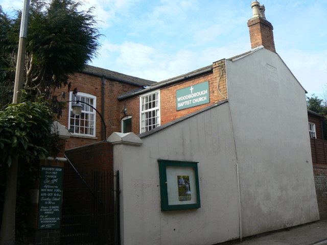
Image: © Alan Murray-Rust Taken: 20 Mar 2011
The datestone in the gable carries the date 1831. The chapel was squeezed into a plot of land 'thirteen yards from east to west and 12 yards from south to north'.
Images are licensed for reuse under creativecommons.org/licenses/by-sa/2.0
Image Location
Latitude
53.024074
Longitude
-1.052202