Flory Island
Introduction
The photograph on this page of Flory Island by Tony Atkin as part of the Geograph project.
The Geograph project started in 2005 with the aim of publishing, organising and preserving representative images for every square kilometre of Great Britain, Ireland and the Isle of Man.

There are currently over 7.5m images from over 14,400 individuals and you can help contribute to the project by visiting https://www.geograph.org.uk
Flory Island
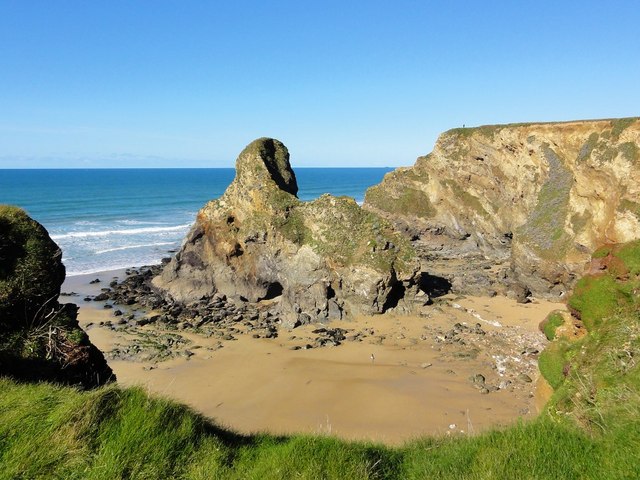
Image: © Tony Atkin Taken: 13 Mar 2011
Flory Island is also named on the O/S map as Black Humphrey Rock. It is a large rock stack standing in the middle of Whipsiderry Beach.
Images are licensed for reuse under creativecommons.org/licenses/by-sa/2.0
Image Location
Latitude
50.428469
Longitude
-5.056243