Park Hill, Croydon
Introduction
The photograph on this page of Park Hill, Croydon by Peter Trimming as part of the Geograph project.
The Geograph project started in 2005 with the aim of publishing, organising and preserving representative images for every square kilometre of Great Britain, Ireland and the Isle of Man.

There are currently over 7.5m images from over 14,400 individuals and you can help contribute to the project by visiting https://www.geograph.org.uk
Park Hill, Croydon
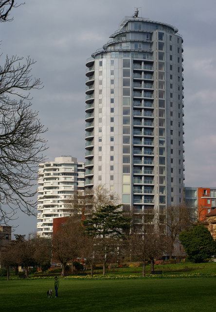
Image: © Peter Trimming Taken: 22 Mar 2011
Looking towards the northern exit of the park, its proximity to Croydon's town centre can be seen. Overlooking Park Hill, is Altitude 25; Croydon's tallest tower block (finished 2009). In the background is the NLA Tower (now No.1 Croydon), located beside East Croydon railway station.
Images are licensed for reuse under creativecommons.org/licenses/by-sa/2.0
Image Location
Latitude
51.37156
Longitude
-0.091232