The Houblon Almshouses, Richmond
Introduction
The photograph on this page of The Houblon Almshouses, Richmond by Stefan Czapski as part of the Geograph project.
The Geograph project started in 2005 with the aim of publishing, organising and preserving representative images for every square kilometre of Great Britain, Ireland and the Isle of Man.

There are currently over 7.5m images from over 14,400 individuals and you can help contribute to the project by visiting https://www.geograph.org.uk
The Houblon Almshouses, Richmond
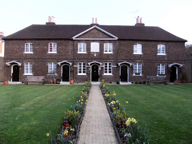
Image: © Stefan Czapski Taken: 20 Mar 2011
The formal design, the dark brickwork, and the small first-floor windows all contribute to a rather stern impression - a little barracks. A tablet over the porch in the middle dates the building to 1758, and reads as follows: THESE ALMS-HOUSES WERE ERECTED AND ENDOWED BY MRS. REBECCA AND MRS. SUSANNAH HOUBLON M.DCC.LVIII The site lies on the boundary of the grid-square. The 1:25,000 sheet suggests that it belongs in this square rather then the next to the north.
Images are licensed for reuse under creativecommons.org/licenses/by-sa/2.0
Image Location
Latitude
51.461331
Longitude
-0.297088