Richmond Street
Introduction
The photograph on this page of Richmond Street by Simon Carey as part of the Geograph project.
The Geograph project started in 2005 with the aim of publishing, organising and preserving representative images for every square kilometre of Great Britain, Ireland and the Isle of Man.

There are currently over 7.5m images from over 14,400 individuals and you can help contribute to the project by visiting https://www.geograph.org.uk
Richmond Street
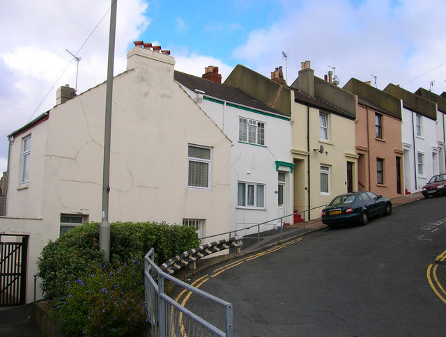
Image: © Simon Carey Taken: 1 Sep 2006
Head north along Elmore Road until it turns east into Richmond Street once one of the steepest streets in Brighton with a gradient of 1:5. To the west of this point a wall was placed across the width of the street to stop runaway carts heading to the bottom. The house on the left, 34A Richmond Street is the last remaining building from Chates Farm that continued operating as a working dairy farm between 1858 and 1934 behind the row of houses in view despite being surrounded by an ever expanding urban area. For a view of an old image of the farm click on this link http://www.mybrightonandhove.org.uk/page_id__5531_path__0p115p192p824p.aspx Click on the link to take you to the next page http://www.geograph.org.uk/photo/231698
Images are licensed for reuse under creativecommons.org/licenses/by-sa/2.0
Image Location
Latitude
50.825968
Longitude
-0.131461