Rochdale: 146 Vine Place
Introduction
The photograph on this page of Rochdale: 146 Vine Place by Dr Neil Clifton as part of the Geograph project.
The Geograph project started in 2005 with the aim of publishing, organising and preserving representative images for every square kilometre of Great Britain, Ireland and the Isle of Man.

There are currently over 7.5m images from over 14,400 individuals and you can help contribute to the project by visiting https://www.geograph.org.uk
Rochdale: 146 Vine Place
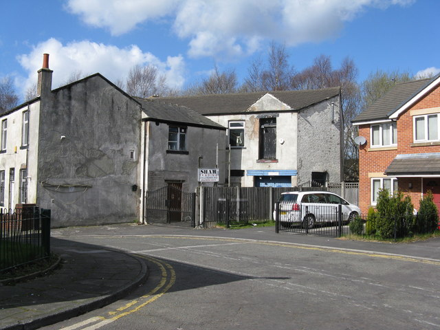
Image: © Dr Neil Clifton Taken: 18 Mar 2011
Almost all the property on this patch of ground just west of Milkstone Road and south of the railway was demolished over 50 years ago, and there has been a large amount of new building. But the group of properties shown here survives from the late Victorian era. It includes, on the extreme left, a house whose address is 146, Vine Place. The number is still proudly displayed on the door, even though every other house in Vine Place had vanished before 1950.
Images are licensed for reuse under creativecommons.org/licenses/by-sa/2.0
Image Location
Latitude
53.608415
Longitude
-2.155935