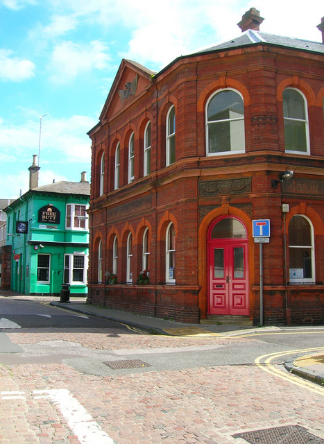
Phoenix Place
Introduction
The photograph on this page of Phoenix Place by Simon Carey as part of the Geograph project.
The Geograph project started in 2005 with the aim of publishing, organising and preserving representative images for every square kilometre of Great Britain, Ireland and the Isle of Man.
There are currently over 7.5m images from over 14,400 individuals and you can help contribute to the project by visiting https://www.geograph.org.uk

Image: © Simon Carey Taken: 1 Sep 2006
Head north along Albion then west then north along Phoenix Place until the road junction in front off the red bricked building has been reached. The building is the former offices of the Phoenix Brewery that operated on this site from 1821 when Tamplins moved from its former premises in Southwick after they burnt down (hence the name Phoenix) and was constructed in 1893. The green building is the Free Butts public house owned by the brewery and a popular local music venue. Tamplins was taken over by Watneys in 1953 who continued brewing from the site until 1973 when it was downgraded to a bottling plant. This finally ceased operating in 1991 and all that remains of the original brewery are the two buildings and the brick street. Click link for a 1968 view http://www.mybrightonandhove.org.uk/page_id__6625_path__0p116p1486p0p116p1486p1498p0p116p169p394p204p635p.aspx Click on the link to take you to the next page. http://www.geograph.org.uk/photo/231584

