Morley Street
Introduction
The photograph on this page of Morley Street by Simon Carey as part of the Geograph project.
The Geograph project started in 2005 with the aim of publishing, organising and preserving representative images for every square kilometre of Great Britain, Ireland and the Isle of Man.

There are currently over 7.5m images from over 14,400 individuals and you can help contribute to the project by visiting https://www.geograph.org.uk
Morley Street
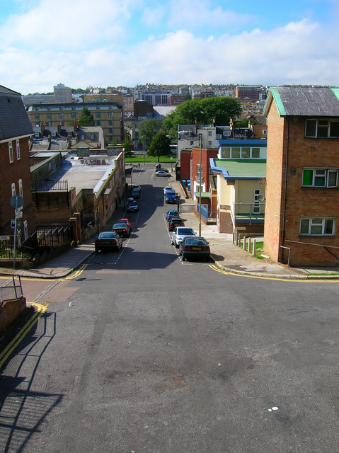
Image: © Simon Carey Taken: 1 Sep 2006
Head north along Nelson Row until Morley Street is reached then east up the stairs to Ashton Hill. Morley Street is the former western end of Sussex Street that was cleared in the 1930s. The slope of the street gives an idea of the steepness of some gradients in this part of town. The back of the Municipal Market is to the left and the southern part of Victoria Gardens is at the bottom of the street. Click on the link to take you to the next page. http://www.geograph.org.uk/photo/231510
Images are licensed for reuse under creativecommons.org/licenses/by-sa/2.0
Image Location


Leaflet Map data © OpenStreetMap
Latitude
50.825115
Longitude
-0.134335