Nelson Row
Introduction
The photograph on this page of Nelson Row by Simon Carey as part of the Geograph project.
The Geograph project started in 2005 with the aim of publishing, organising and preserving representative images for every square kilometre of Great Britain, Ireland and the Isle of Man.

There are currently over 7.5m images from over 14,400 individuals and you can help contribute to the project by visiting https://www.geograph.org.uk
Nelson Row
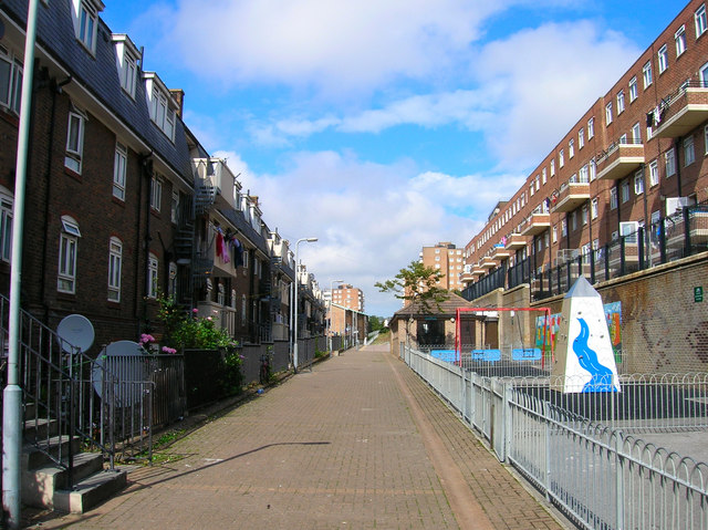
Image: © Simon Carey Taken: 1 Sep 2006
Head north along John Street to the junction with Carlton Hill head south a little until the junction with Nelson Row. The original Nelson Row along the Nelson Place and Woburn were some of the most deprived areas in Brighton during the early part of the 20th century and were some of the earliest to be cleared. Milner Flats to the left and Kingswood Flats to the right were constructed by the corporation in 1934 and 1938 respectively. Click on the link to take you to the next page. http://www.geograph.org.uk/photo/231502
Images are licensed for reuse under creativecommons.org/licenses/by-sa/2.0
Image Location
Latitude
50.824216
Longitude
-0.134371