Out of the woods
Introduction
The photograph on this page of Out of the woods by Jonathan Kington as part of the Geograph project.
The Geograph project started in 2005 with the aim of publishing, organising and preserving representative images for every square kilometre of Great Britain, Ireland and the Isle of Man.

There are currently over 7.5m images from over 14,400 individuals and you can help contribute to the project by visiting https://www.geograph.org.uk
Out of the woods
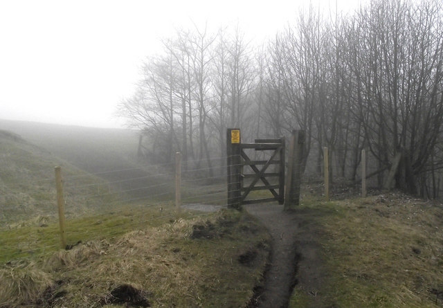
Image: © Jonathan Kington Taken: 16 Mar 2011
This gate leads out of Grin Low Wood and onto the grassland beyond. From the mid 17th century the hillside of Grin Low became extensively worked for lime which was burnt to provide fertiliser for local farmers and mortar for builders. By the 19th century it had become a terrible eyesore visible from the town of Buxton, which was rapidly gaining a reputation as a spa town. By 1820 visitors to the town were complaining and the 6th Duke of Devonshire stepped in and planted 100 acres of woodland to hide the scars, spoil heaps and smoke from the town. The main species planted by the Duke were Beech, Ash, Elm and Sycamore interspersed with the occasional Whitebeam, Oak, Cherry, Lime, Pine and Horse Chestnut. Shrubs such as Willow, Birch, Hawthorn and Rowan were planted around the edges. Today the wood is owned and managed by the Buxton Civic Association who keep it open to the public. Along with the rest of Buxton Country Park it is rated as a Site of Special Scientific Interest (SSSI).
Images are licensed for reuse under creativecommons.org/licenses/by-sa/2.0
Image Location
Latitude
53.2485
Longitude
-1.934154