Farmhouse, Loughton
Introduction
The photograph on this page of Farmhouse, Loughton by Derek Harper as part of the Geograph project.
The Geograph project started in 2005 with the aim of publishing, organising and preserving representative images for every square kilometre of Great Britain, Ireland and the Isle of Man.

There are currently over 7.5m images from over 14,400 individuals and you can help contribute to the project by visiting https://www.geograph.org.uk
Farmhouse, Loughton
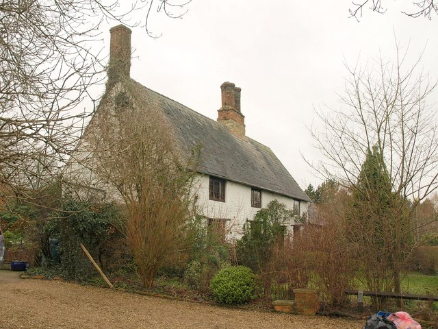
Image: © Derek Harper Taken: 4 Feb 2011
Cell Farmhouse has a steep-pitched roof - might that indicate it was once thatched? According to http://www.britishlistedbuildings.co.uk/en-45850-cell-farmhouse-1-loughton , it could be C16.
Images are licensed for reuse under creativecommons.org/licenses/by-sa/2.0
Image Location
Latitude
52.031075
Longitude
-0.784423