St Clement's Church, Urmston
Introduction
The photograph on this page of St Clement's Church, Urmston by David Dixon as part of the Geograph project.
The Geograph project started in 2005 with the aim of publishing, organising and preserving representative images for every square kilometre of Great Britain, Ireland and the Isle of Man.

There are currently over 7.5m images from over 14,400 individuals and you can help contribute to the project by visiting https://www.geograph.org.uk
St Clement's Church, Urmston
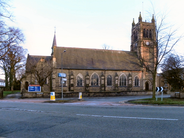
Image: © David Dixon Taken: 13 Mar 2011
In the mid 19th century, Urmston was a small rural community with a population of only 730; it was then part of Flixton parish. The expansion of industry and the coming of the railway caused the population to grow rapidly and it was recognised that Urmston needed a church of its own. The foundation stone was laid by the first Bishop of Manchester on 16 March 1867 and the building was consecrated just 9 months later. http://www.stclementsonline.co.uk/about_history.asp - Church web site
Images are licensed for reuse under creativecommons.org/licenses/by-sa/2.0
Image Location
Latitude
53.445132
Longitude
-2.350609