Duke Street, looking southeast, Cheltenham
Introduction
The photograph on this page of Duke Street, looking southeast, Cheltenham by P L Chadwick as part of the Geograph project.
The Geograph project started in 2005 with the aim of publishing, organising and preserving representative images for every square kilometre of Great Britain, Ireland and the Isle of Man.

There are currently over 7.5m images from over 14,400 individuals and you can help contribute to the project by visiting https://www.geograph.org.uk
Duke Street, looking southeast, Cheltenham
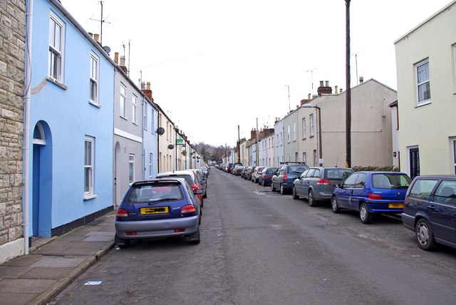
Image: © P L Chadwick Taken: 6 Mar 2011
Duke Street has gone up in the world in recent years. Much of it was built in the 1820's, as homes for manual labourers. It wouldn't have looked as pretty as it does now. There used to be three pubs in the street. The Marlborough Arms was a mid-Victorian beerhouse, on the corner of Duke Street and Prince's Street, and closed around the 1930's, to become a private house. Another beerhouse was the Duke's Head at No. 77 (formerly numbered 66), which dates from the 1830's and closed around the beginning of the Second World War. It is now a private house. Finally there was the Talbot Inn at no. 14 (probably 28 under the previous numbering). This was in business by mid-Victorian times, and managed to hang on until closure in 1984. It is now three dwellings (14, 14a & 14b). Fortunately there is still a pub around the corner in Hewlett Road (The Fiery Angel). Image
Images are licensed for reuse under creativecommons.org/licenses/by-sa/2.0
Image Location
Latitude
51.898508
Longitude
-2.064917