Highbury and Islington Station
Introduction
The photograph on this page of Highbury and Islington Station by Dr Neil Clifton as part of the Geograph project.
The Geograph project started in 2005 with the aim of publishing, organising and preserving representative images for every square kilometre of Great Britain, Ireland and the Isle of Man.

There are currently over 7.5m images from over 14,400 individuals and you can help contribute to the project by visiting https://www.geograph.org.uk
Highbury and Islington Station
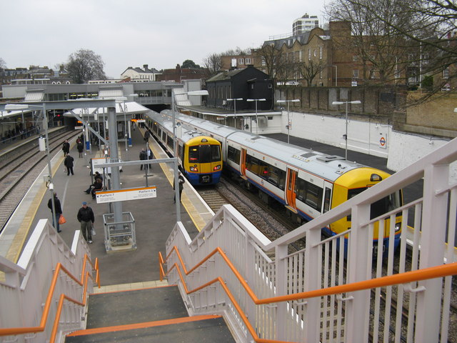
Image: © Dr Neil Clifton Taken: 1 Mar 2011
When I first knew this station, back in 1954, it was just two separate stations, with the electric North London line (on the surface) using the two right-hand tracks shown on this photograph: the other two surface tracks were unused. Far below was quite a separate station, belonging to London Underground, which was on a small and obscure branch of the Northern Line, with trains running only between Moorgate and Finsbury Park. Now in 2011 the station has developed into a complex and important interchange point, with two underground lines - the Victoria Line of the Underground, and a National Rail line worked by First Capital Connect, with trains from Moorgate to distant destinations in Hertfordshire and Cambridgeshire. On the surface is the modernised North London line, which uses the two left-hand (unoccupied here) tracks. The latest development, which was only inaugurated the day before this photograph, has been the extension to this station of the East London line from Dalston Junction. The East London trains terminate here: on the extreme right, from West Croydon; and next right, from Crystal Palace.
Images are licensed for reuse under creativecommons.org/licenses/by-sa/2.0
Image Location
Latitude
51.546139
Longitude
-0.10427