Seymour Almshouses, Langley Marish
Introduction
The photograph on this page of Seymour Almshouses, Langley Marish by Stefan Czapski as part of the Geograph project.
The Geograph project started in 2005 with the aim of publishing, organising and preserving representative images for every square kilometre of Great Britain, Ireland and the Isle of Man.

There are currently over 7.5m images from over 14,400 individuals and you can help contribute to the project by visiting https://www.geograph.org.uk
Seymour Almshouses, Langley Marish
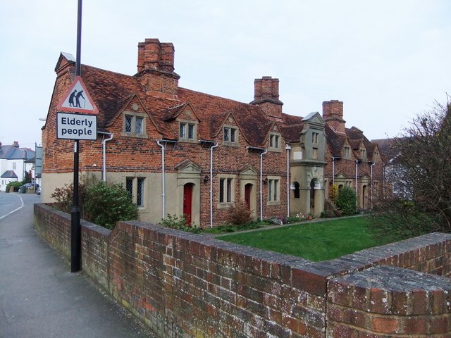
Image: © Stefan Czapski Taken: 15 Mar 2011
These almshouses stand on the north side of the churchyard, while the somewhat older Kederminster almshouses stand on its south side http://www.geograph.org.uk/photo/2309292. The two sets of buildings are generally similar - redbrick cottages, with gabled dormers. An inscription on the Kederminster buildings dates them to 1617, while these are said to date from the 1670's and 80's http://www.britishlistedbuildings.co.uk/en-38733-12-14-16-18-20-22-slough. For a view from the churchyard see: http://www.geograph.org.uk/photo/2310827
Images are licensed for reuse under creativecommons.org/licenses/by-sa/2.0
Image Location
Latitude
51.506131
Longitude
-0.552913