Swing bridge in Diglis Basin, Worcester
Introduction
The photograph on this page of Swing bridge in Diglis Basin, Worcester by Roger D Kidd as part of the Geograph project.
The Geograph project started in 2005 with the aim of publishing, organising and preserving representative images for every square kilometre of Great Britain, Ireland and the Isle of Man.

There are currently over 7.5m images from over 14,400 individuals and you can help contribute to the project by visiting https://www.geograph.org.uk
Swing bridge in Diglis Basin, Worcester
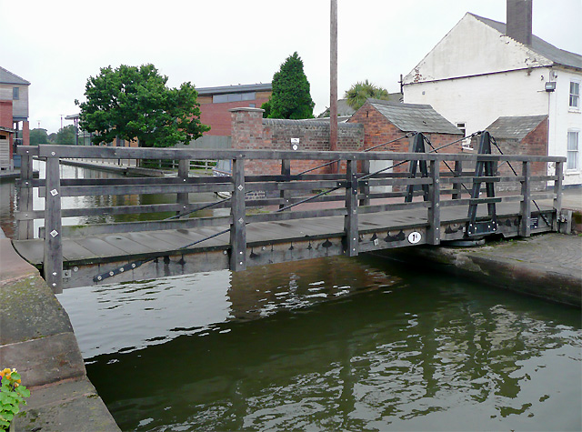
Image: © Roger D Kidd Taken: 20 Aug 2010
The bridge allows access to a narrow wharf. Off to the right of the white cottage is the upper broad lock, No 2 on the Worcester and Birmingham Canal. A lot of canalside redevelopment is in progress in the vicinity of Diglis Basin. Some buildings are listed and will be preserved.
Images are licensed for reuse under creativecommons.org/licenses/by-sa/2.0
Image Location
Latitude
52.182872
Longitude
-2.221155