Lerryn Bridge
Introduction
The photograph on this page of Lerryn Bridge by Derek Harper as part of the Geograph project.
The Geograph project started in 2005 with the aim of publishing, organising and preserving representative images for every square kilometre of Great Britain, Ireland and the Isle of Man.

There are currently over 7.5m images from over 14,400 individuals and you can help contribute to the project by visiting https://www.geograph.org.uk
Lerryn Bridge
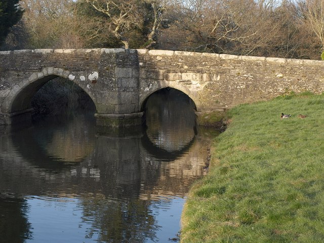
Image: © Derek Harper Taken: 6 Mar 2011
The C16 bridge ("repaired in 1573 ... Queen Elizabeth issued an order to the bailiff and constables of the Hundred of the West to levy a rate for the erecting and re-edifying of a decayed bridge called 'Laryon Bridge' http://www.britishlistedbuildings.co.uk/en-60622-lerryn-bridge-st-veep ) across the River Lerryn. This is the downstream side.
Images are licensed for reuse under creativecommons.org/licenses/by-sa/2.0
Image Location
Latitude
50.384779
Longitude
-4.616454