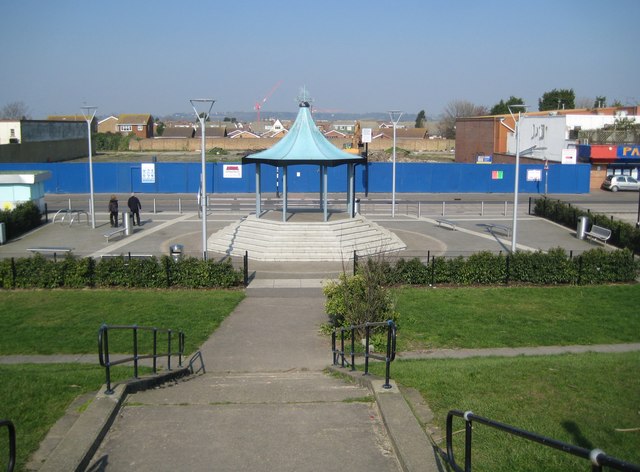
Canvey Island: The Bandstand
Introduction
The photograph on this page of Canvey Island: The Bandstand by Nigel Cox as part of the Geograph project.
The Geograph project started in 2005 with the aim of publishing, organising and preserving representative images for every square kilometre of Great Britain, Ireland and the Isle of Man.
There are currently over 7.5m images from over 14,400 individuals and you can help contribute to the project by visiting https://www.geograph.org.uk

Image: © Nigel Cox Taken: 8 Mar 2011
Canvey Island's bandstand was refurbished a few years ago, before 2009 for sure, by Castle Point Borough Council at a cost of about £165,000. Contemporary newspaper reports suggest that some criticism of the cost, the usefulness, and the small size of the refurbished bandstand, was expressed by members of the local Canvey Island town council and local residents. The site behind the bandstand and beyond the blue hoarding is currently being redeveloped for residential use. Just to the right of the bandstand the black pole on the far pavement is a solar-powered road sign.

