Invererne
Introduction
The photograph on this page of Invererne by Anne Burgess as part of the Geograph project.
The Geograph project started in 2005 with the aim of publishing, organising and preserving representative images for every square kilometre of Great Britain, Ireland and the Isle of Man.

There are currently over 7.5m images from over 14,400 individuals and you can help contribute to the project by visiting https://www.geograph.org.uk
Invererne
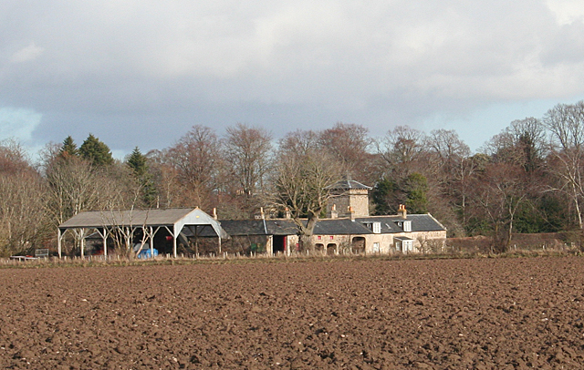
Image: © Anne Burgess Taken: 11 Mar 2011
The farm and buildings, sheltered from the north by a clump of mature trees, stands in the middle of the flat flood plain north of Forres. Its name used to be Tannachy, but it was altered to Invererne some time before 1834. Invererne House itself, a category A listed building, is hidden by the trees. The steading, seen here, dates from 1818 and is category B listed. Pity about the modern dutch barn to the left.
Images are licensed for reuse under creativecommons.org/licenses/by-sa/2.0
Image Location
Latitude
57.624635
Longitude
-3.624603