Great Central Way, Leicester
Introduction
The photograph on this page of Great Central Way, Leicester by Malc McDonald as part of the Geograph project.
The Geograph project started in 2005 with the aim of publishing, organising and preserving representative images for every square kilometre of Great Britain, Ireland and the Isle of Man.

There are currently over 7.5m images from over 14,400 individuals and you can help contribute to the project by visiting https://www.geograph.org.uk
Great Central Way, Leicester
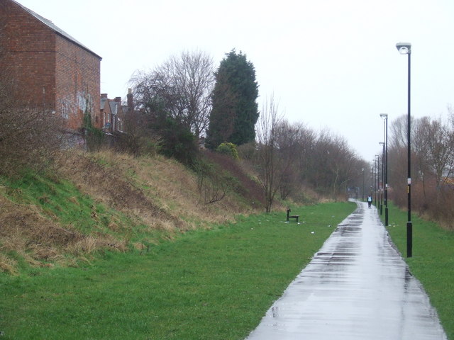
Image: © Malc McDonald Taken: 27 Feb 2011
Great Central Way is a shared footpath and cycle path in Leicester. It follows the route of the Great Central Railway, which was closed in 1969. The sloped bank along the left-hand side of the picture is a clue that this was once part of a railway.
Images are licensed for reuse under creativecommons.org/licenses/by-sa/2.0
Image Location
Latitude
52.623676
Longitude
-1.147737