Broadleaf trees in Tyntesfield Park
Introduction
The photograph on this page of Broadleaf trees in Tyntesfield Park by Stuart Logan as part of the Geograph project.
The Geograph project started in 2005 with the aim of publishing, organising and preserving representative images for every square kilometre of Great Britain, Ireland and the Isle of Man.

There are currently over 7.5m images from over 14,400 individuals and you can help contribute to the project by visiting https://www.geograph.org.uk
Broadleaf trees in Tyntesfield Park
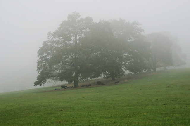
Image: © Stuart Logan Taken: 28 Oct 2006
On a damp and misty autumn day cattle shelter under several large parkland trees. These show the characteristic flat underside termed a 'grazing line'. It is formed, parallel to the ground, when large herbivores (cows, deer etc) reach up to eat the foliage.
Images are licensed for reuse under creativecommons.org/licenses/by-sa/2.0
Image Location
Latitude
51.437431
Longitude
-2.71525