St George's Lane and bus station
Introduction
The photograph on this page of St George's Lane and bus station by Nick Smith as part of the Geograph project.
The Geograph project started in 2005 with the aim of publishing, organising and preserving representative images for every square kilometre of Great Britain, Ireland and the Isle of Man.

There are currently over 7.5m images from over 14,400 individuals and you can help contribute to the project by visiting https://www.geograph.org.uk
St George's Lane and bus station
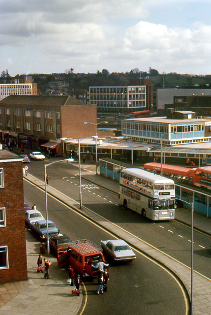
Image: © Nick Smith Taken: Unknown
Now redeveloped, this view of St George's Lane is taken from the old Watling Street multistorey car park which was demolished to make way for the Whitefriars shopping centre http://www.canterbury.gov.uk/main.cfm?objectid=72 Note the Simon Langton School pupils disembarking from the school mini bus outside the Coach and Horses pub. The photo taken date is a 'best estimate'.
Images are licensed for reuse under creativecommons.org/licenses/by-sa/2.0
Image Location
Latitude
51.276392
Longitude
1.082349