The Shambles, Malton
Introduction
The photograph on this page of The Shambles, Malton by David Rogers as part of the Geograph project.
The Geograph project started in 2005 with the aim of publishing, organising and preserving representative images for every square kilometre of Great Britain, Ireland and the Isle of Man.

There are currently over 7.5m images from over 14,400 individuals and you can help contribute to the project by visiting https://www.geograph.org.uk
The Shambles, Malton
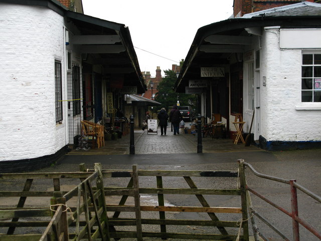
Image: © David Rogers Taken: 23 Feb 2011
This Grade II listed thoroughfare with a row of shops on either side dates from the early-mid 19th century and was laid out to link the Market Place with what was then the newly opened cattle market. The shops are thought to have originally been butchers' shops.
Images are licensed for reuse under creativecommons.org/licenses/by-sa/2.0
Image Location
Latitude
54.135785
Longitude
-0.799732