Burton Stone
Introduction
The photograph on this page of Burton Stone by shirokazan as part of the Geograph project.
The Geograph project started in 2005 with the aim of publishing, organising and preserving representative images for every square kilometre of Great Britain, Ireland and the Isle of Man.

There are currently over 7.5m images from over 14,400 individuals and you can help contribute to the project by visiting https://www.geograph.org.uk
Burton Stone
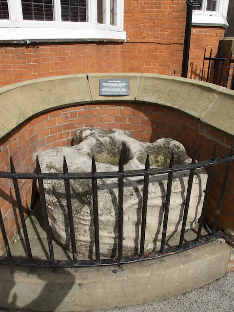
Image: © shirokazan Taken: 28 Aug 2010
Outside the public house of the same name. According to the sign behind, it is believed to be the base of a cross which formed a city boundary marker.
Images are licensed for reuse under creativecommons.org/licenses/by-sa/2.0
Image Location
Latitude
53.967398
Longitude
-1.092673