An Old Methodist Chapel on Trevellas Downs
Introduction
The photograph on this page of An Old Methodist Chapel on Trevellas Downs by Tony Atkin as part of the Geograph project.
The Geograph project started in 2005 with the aim of publishing, organising and preserving representative images for every square kilometre of Great Britain, Ireland and the Isle of Man.

There are currently over 7.5m images from over 14,400 individuals and you can help contribute to the project by visiting https://www.geograph.org.uk
An Old Methodist Chapel on Trevellas Downs
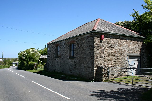
Image: © Tony Atkin Taken: 2 Jun 2006
This building now appears to be used as a garage or workshop. Its location is exactly coincident with a building shown on the 1880's map as a Methodist Chapel so judging by the look of the building I would guess it is old enough to be that chapel.
Images are licensed for reuse under creativecommons.org/licenses/by-sa/2.0
Image Location


Leaflet Map data © OpenStreetMap
Latitude
50.320902
Longitude
-5.176209