Long Moll's Bridge near Calf Heath, Staffordshire
Introduction
The photograph on this page of Long Moll's Bridge near Calf Heath, Staffordshire by Roger D Kidd as part of the Geograph project.
The Geograph project started in 2005 with the aim of publishing, organising and preserving representative images for every square kilometre of Great Britain, Ireland and the Isle of Man.

There are currently over 7.5m images from over 14,400 individuals and you can help contribute to the project by visiting https://www.geograph.org.uk
Long Moll's Bridge near Calf Heath, Staffordshire
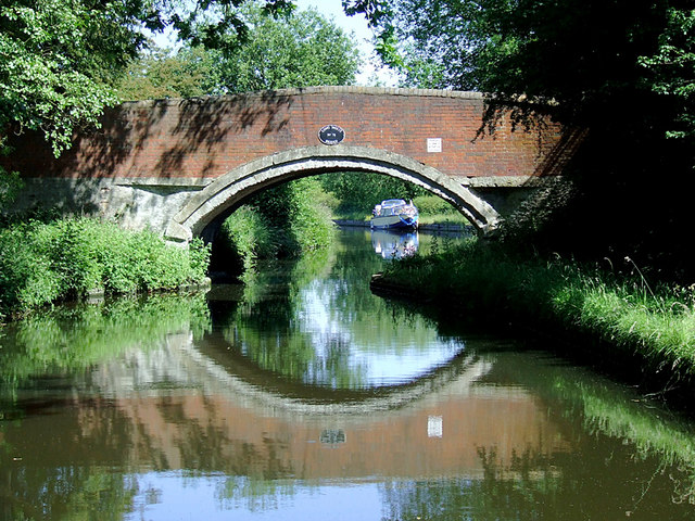
Image: © Roger D Kidd Taken: 21 Jun 2010
Bridge No 76 across the Staffordshire and Worcestershire Canal. These old numberings give a slightly misleading idea of the quantity of bridges still in place on the canal. Some farm accommodation bridges, swing bridges, or lift bridges no longer exist, and some new road bridges have been added. I have not discovered who Long Moll was, or whether the name is masculine or feminine. (Moll was a male personal name in the mediaeval and "dark" ages). This is on the ten mile long summit pound of the Staffordshire and Worcestershire Canal which goes from Gailey to Compton (Wolverhampton). The six inch stop lock at Autherley Junction is the only blockage on the Shropshire Union Canal for eight miles until Wheaton Aston, so the whole area around here is popular for cruising with minimal work.
Images are licensed for reuse under creativecommons.org/licenses/by-sa/2.0
Image Location
Latitude
52.675631
Longitude
-2.106355