Cones and catkins
Introduction
The photograph on this page of Cones and catkins by Jonathan Kington as part of the Geograph project.
The Geograph project started in 2005 with the aim of publishing, organising and preserving representative images for every square kilometre of Great Britain, Ireland and the Isle of Man.

There are currently over 7.5m images from over 14,400 individuals and you can help contribute to the project by visiting https://www.geograph.org.uk
Cones and catkins
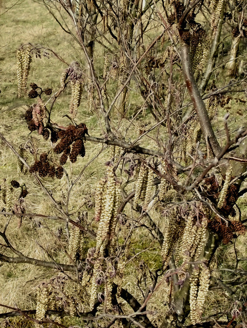
Image: © Jonathan Kington Taken: 3 Mar 2011
Showing the female cones and male catkins on the Image The Common Alder (Alnus glutinosa) is a common tree that can be found just about anywhere although its preferred habitat is normally in clumps on riversides (riparian). They are excellent trees for increasing the fertility of soil due to its ability to fix nitrogen from the air through its leaves. Alders are a member of the Birch family and as such are considered ‘pioneer’ plants, growing quickly but not living for long- typically about 150 years. They will grow to a maximum of 25 metres with an annual growth of up 90 cm a year. The Alder is monoecious, or asexual, with each tree carrying both male and female flowers. The male flowers come in the form of dark-yellow catkins up to 5 cm long; the female flowers are in the shape of a red conifer-like cone and are up to 6 mm in size. The 11.8 hectare Brindley Meadow started life in the 19th century as a sandstone quarry known as Knypersley Quarry. In later years it became a dumping ground for slag from a nearby foundry and for shale from local mining activities, this was to continue until the site was abandoned and left derelict in the 1960’s. In the mid-1990’s a development company, Banks Group ( http://www.banksgroup.co.uk/ ), became involved and applied for, and secured, planning permission to reclaim the quarry. This involved the extraction of coal from underneath the quarry between 1997 and 1999 and the tipping of 250,000 tonnes of inert material into the quarry between 2000 and 2002, with the final reclamation finished in the same year. Approximately 50% of the site is planted with trees to create woodland, the rest with wildflowers and shrubs.
Images are licensed for reuse under creativecommons.org/licenses/by-sa/2.0
Image Location
Latitude
53.091168
Longitude
-2.178395