Looking to the entrance
Introduction
The photograph on this page of Looking to the entrance by Jonathan Kington as part of the Geograph project.
The Geograph project started in 2005 with the aim of publishing, organising and preserving representative images for every square kilometre of Great Britain, Ireland and the Isle of Man.

There are currently over 7.5m images from over 14,400 individuals and you can help contribute to the project by visiting https://www.geograph.org.uk
Looking to the entrance
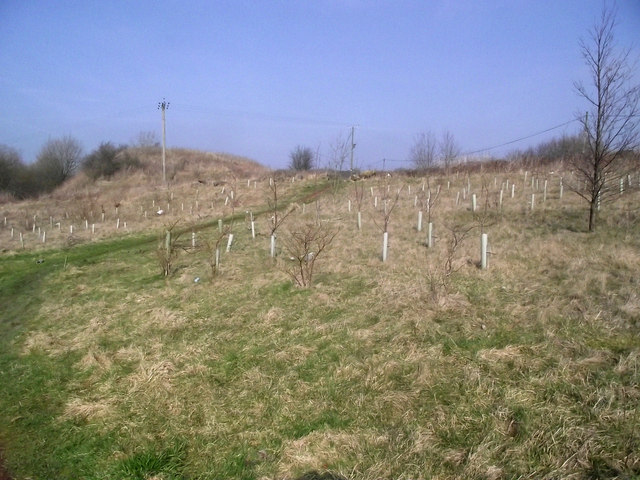
Image: © Jonathan Kington Taken: 3 Mar 2011
Looking back towards the north-eastern entrance to Brindley Meadow, emerging on the junction of Childerplay Road and Bemersley Road. The 11.8 hectare Brindley Meadow started life in the 19th century as a sandstone quarry known as Knypersley Quarry. In later years it became a dumping ground for slag from a nearby foundry and for shale from local mining activities, this was to continue until the site was abandoned and left derelict in the 1960’s. In the mid-1990’s a development company, Banks Group ( http://www.banksgroup.co.uk/ ), became involved and applied for, and secured, planning permission to reclaim the quarry. This involved the extraction of coal from underneath the quarry between 1997 and 1999 and the tipping of 250,000 tonnes of inert material into the quarry between 2000 and 2002, with the final reclamation finished in the same year. Approximately 50% of the site is planted with trees to create woodland, the rest with wildflowers and shrubs.
Images are licensed for reuse under creativecommons.org/licenses/by-sa/2.0
Image Location
Latitude
53.091805
Longitude
-2.178995