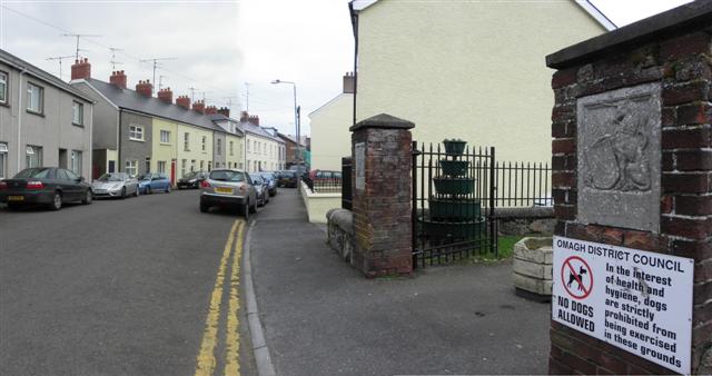
Campsie Crescent, Omagh
Introduction
The photograph on this page of Campsie Crescent, Omagh by Kenneth Allen as part of the Geograph project.
The Geograph project started in 2005 with the aim of publishing, organising and preserving representative images for every square kilometre of Great Britain, Ireland and the Isle of Man.
There are currently over 7.5m images from over 14,400 individuals and you can help contribute to the project by visiting https://www.geograph.org.uk

Image: © Kenneth Allen Taken: 5 Mar 2011
Heading south-east towards Campsie Road / Lower Market Street To the right is the entrance to King George's Field, dedicated to King George V, marked by the twin brick piers with inset stone heraldic panels. There are 344 of them in England, 85 in Scotland, 35 in Wales and 7 in Northern Ireland. In the case of England, Wales and Northern Ireland, the panel on the left is the Lion, holding a Royal Shield, with the words 'George V' underneath, and below them 'A.D. 1910-1936'; and on the right is the Unicorn holding a similar shield with the words 'King George’s Field' underneath. In the case of Scotland, the relative positions of the Lion and the Unicorn are reversed, and the Scottish arms take prior place in the Shield and the Unicorn wears a crown. The wording below is identical. The left panel is here Image] and this is the right panel Image]

