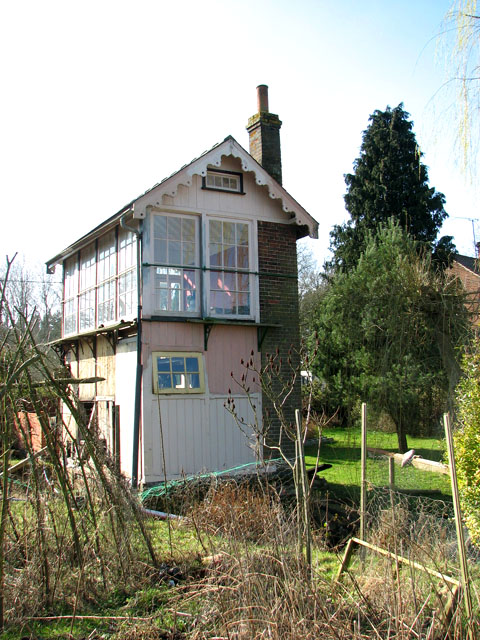
Langor Bridge railway station - signal box
Introduction
The photograph on this page of Langor Bridge railway station - signal box by Evelyn Simak as part of the Geograph project.
The Geograph project started in 2005 with the aim of publishing, organising and preserving representative images for every square kilometre of Great Britain, Ireland and the Isle of Man.
There are currently over 7.5m images from over 14,400 individuals and you can help contribute to the project by visiting https://www.geograph.org.uk

Image: © Evelyn Simak Taken: 4 Mar 2011
Langor Bridge (east of Fakenham) was a station on the Midland & Great Northern Railway and controlled a level crossing > http://www.geograph.org.uk/photo/1935816 crossover and siding > http://www.geograph.org.uk/photo/2294014 from its 18-lever frame. The line opened in 1891 and closed in 1959. At first the Great Northern Railway provided the signalling on the M&GNR between Bourne and Lynn and the signal boxes were similar to the Great Northern designs of the time. The two types can, however, commonly be distinguished by the Railway Signal Company bargeboards affixed to the latter. From 1894 onwards the M&GN had its own design of signal box and Langor Bridge is believed to be a fine example with the most notable features being the vertical paneling and four-pane high windows extending into the eaves. The signal box is now in a private garden. This image was taken by kind permission of the owner. For more detail read: http://www.signalbox.org/gallery/e/langorbridge.php What used to be goods yard and sidings has since been turned into private gardens > http://www.geograph.org.uk/photo/2294014. Nothing but the original signal box and its toilet > http://www.geograph.org.uk/photo/2294059 as well as a platelayer's hut > http://www.geograph.org.uk/photo/2294043 and a crossing gate > http://www.geograph.org.uk/photo/2294024 remain.

